

Vittoriosa to Valletta - WalkingWednesday, 9th November 2005
Approximate Distance 5 miles
Getting to Vittoriosa - No. 22 bus from Marsascala or a no. 1, 2, 4 or 6 from Valletta.
As stated on the link to this page, it may have been considered that taking "the boat" across the Grand Harbour to get to Valletta from Vittoriosa was a "bit of a cheat", so on this latest excursion to Malta it was decided that we should walk between the two locations. So having caught the bus from Marsascala, where we were staying, we arrived at Vittoriosa at about 11 o'clock on a glorious sunny morning.
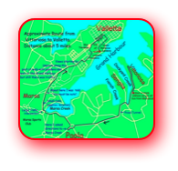
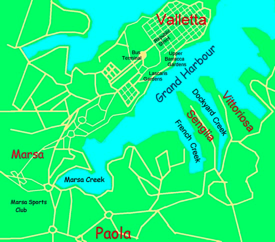
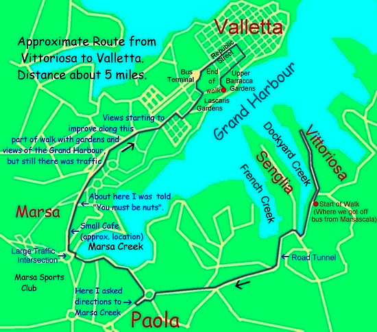
Map of area between
Vittoriosa and Valletta
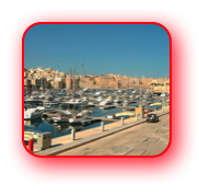
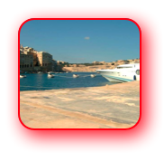
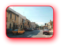
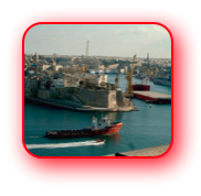
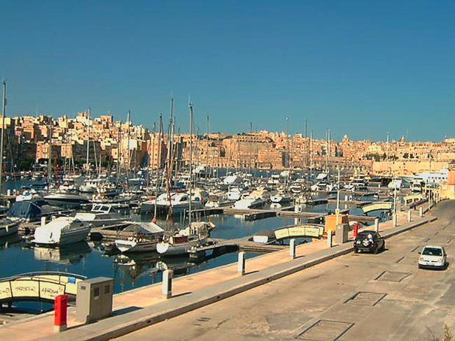
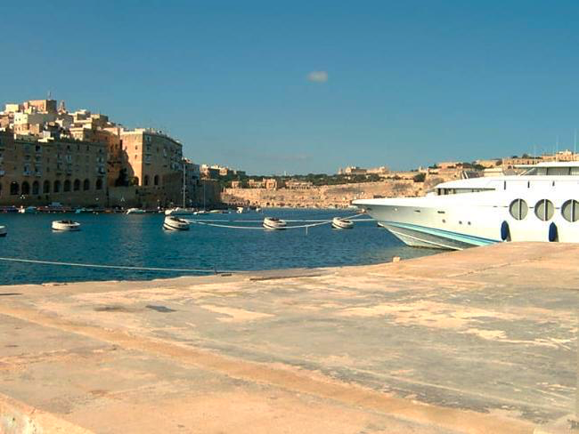
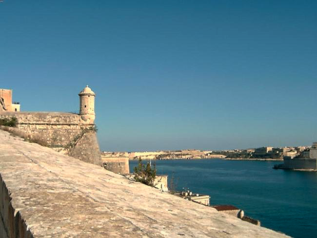
Initially we had a look around the beautiful harbour/marina (Dockyard Creek) and admired the boats there, including some very expensive looking ocean going yachts. We then left the waterfront and turned right towards Senglia. Immediately we met a less pleasant aspect of Malta - traffic. The Maltese love their cars and here we started to encounter them; the noise and general closeness to them was certainly a contrast to the serenity of the waterfront at Vittoriosa, which we had just left behind.
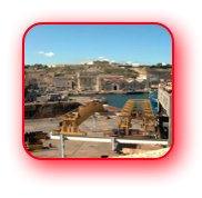
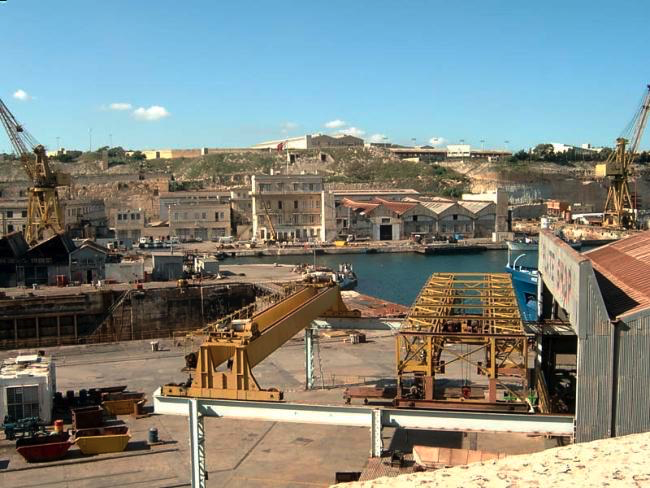
Reaching the southern side of Senglia, we turned right (north) as if we were going to go to the end of the peninsular on which it is situated, but then we immediately went left and ascended a steep street/road. At the top of this rise we were able to look down on our right to the industrial area around French Creek. This was very much a contrast to Dockyard Creek with cranes and engineering rather than the expensive boats we had seen earlier.
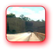
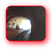
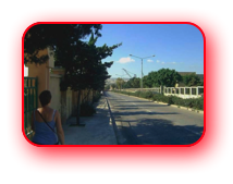
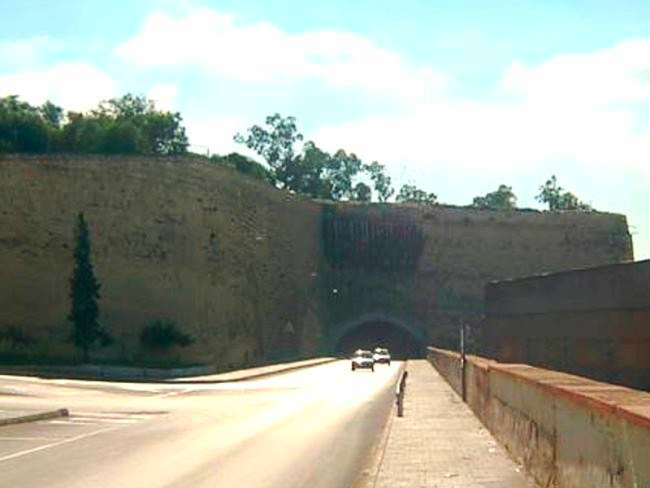
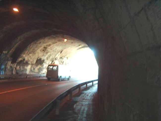
Continuing we soon found ourselves going through a road tunnel and were pleased to exit it - exhaust fumes are not very pleasant - to reach the outskirts of Paola.
Somewhere along our route towards Paola I missed a turn to the right, which existed on the map I was using but was no longer apparent on the ground! So I asked a Maltese Lady directions. The conversation went something like this.
"Excuse me, can you tell me the best way to get to Marsa Creek" ( I knew we should go close to this).
"Marsa Creek!"
"Yes, we are going to Valletta"
"You need the bus"
"No we want to walk there"
"You need the bus"
"But we're walking"
(I'm half expecting her to say "You English you’re crazy" but she holds it back and says),
"You need to go back, turn left and, at the next traffic island, follow the bus route"
So we turned around before turning left, leaving behind a Maltese Lady who clearly thought we were a bit "strange" or even worse.
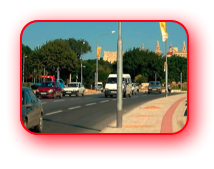
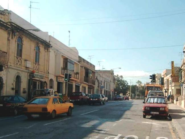
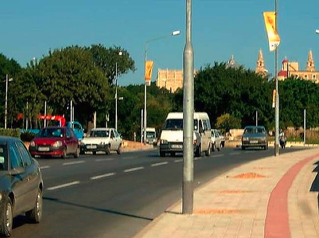
By now Anne was saying that she wasn't enjoying this walk. And I was saying "Don't worry it should soon get better; we can take a turn to the right and get to a less congested road nearer the Grand Harbour".
We reached a small cafe just beyond the massive Marsa Traffic Island, so I went inside to ask if we could get to the Grand Harbour and walk alongside it into Valletta.
"Follow signs and bus route" was the response. So we continued to enjoy the traffic (dual carriageway at this point) as we headed ever onwards towards Valletta.
And then we came to a junction and the main road went left, which I felt was not the right direction, so I asked a group of men outside a business called Billy Engineers.
"We're walking to Valletta. Can you tell me the way to go please?" To which one of the group replied - "You must be nuts". But he did give me directions, which were to the right of the bus route, up the hill past a church on the left, and by a Recreation Ground and then straight on.
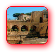
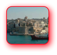
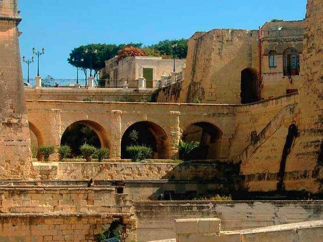
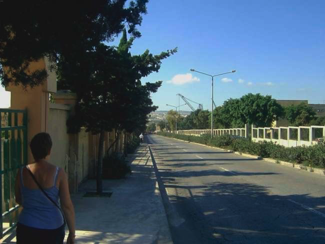
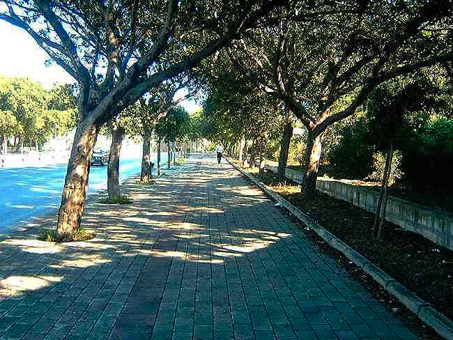
Reaching the Recreation Ground - gardens with a children's play area - we stopped to have a drink and a short rest away from the traffic. From here it was much easier. Although we had the traffic with us on our left, on our right we started to get views of the Grand Harbour and soon we were able to walk through gardens and along pavements more protected from the busy road. It was certainly a much more comfortable and interesting walk from this point on. We even took a minor detour to visit the Lascaris Gardens, which, besides the flora which Anne really enjoyed, had wonderful views across the Grand Harbour. Then we entered Valletta through the Bus Terminal. This certainly seemed an appropriate way into the city.
Views from the Lascaris Gardens.
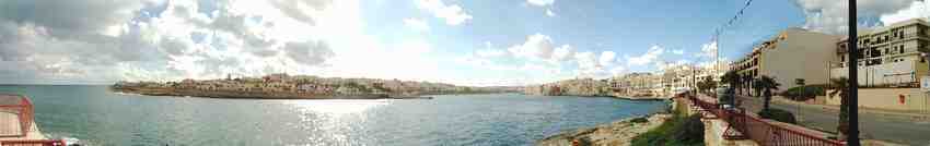
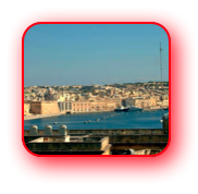
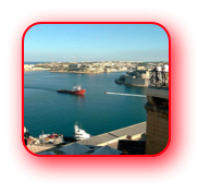
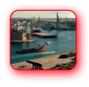
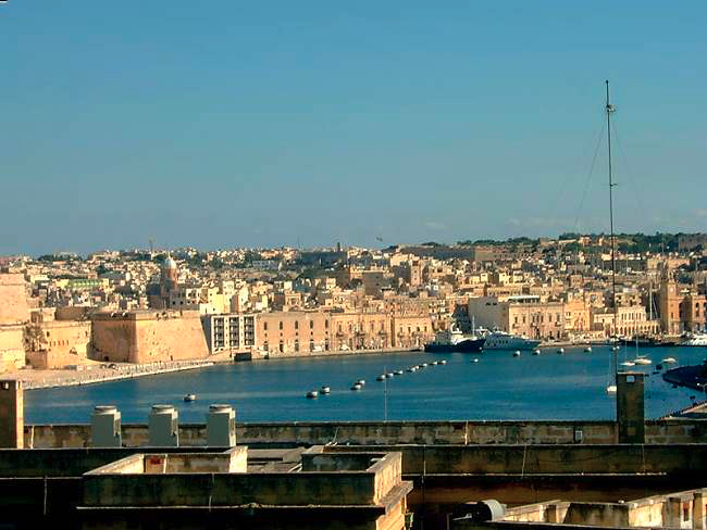
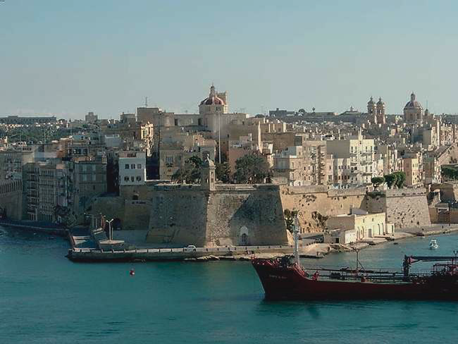
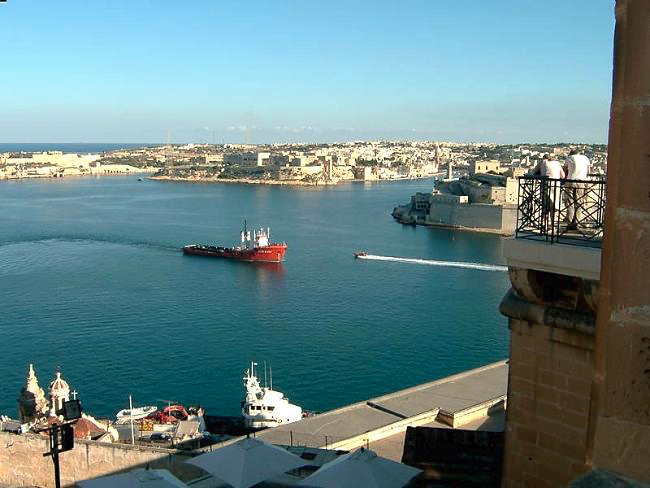
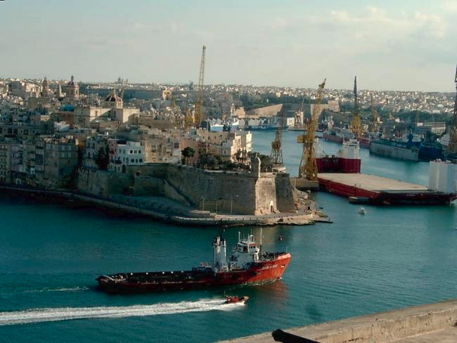
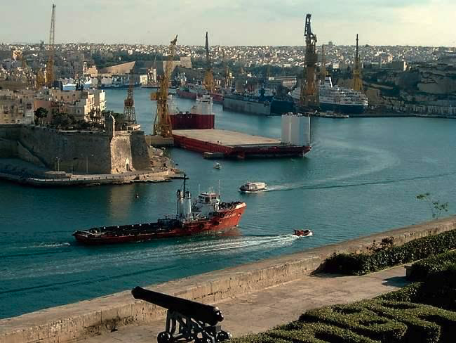
From here, after a brief wander around Republic Street, the city's main thoroughfare, we went to the Upper Barracca Gardens. Here are some of the best views of the Grand Harbour; it's one of our favourite parts of Valletta.
Views from the Upper Barracca Gardens.
Map of area between Vittoriosa and
Valletta showing our route
Would I do this walk again? Probably not and certainly if I asked Anne to do it again I know what the answer would be. Although looking at a different map to the one I used on the walk - this one has more detail of the approach into Valletta - it would seem that we should have been able to get to a road that skirted the Grand Harbour and taken us away from the noise and traffic of our route. Still it was an "unforgettable" experience.
Don't forget if you want to see our route from Valletta to Sliema it is available at brilwalks.com.
Since writing the above I received an email from Vince Debono, a tour guide in Malta, part of which is included below....
......Re the walk between Vittoriosa and Valletta, there is a possibility of approaching Valletta away from the bus route. At the point where you were labelled as Nuts, at the Billy Engineers, you should (next time?) take the route past the power station down to the harbour. Past the Sea Malta offices, on to the Viset Cruise Liner Terminal , customs house and through Lascaris Bastion then
1) either follow the water and up to Fort St. Elmo near the Siege Bell or
2) go left in through Victoria Gate past the British Hotel....
More emails followed. These culminated in Vince sending photographs and route details. So if you are interested in the route from the Marsa Traffic Intersection to Valletta then Click Here .
Return to top of page
Wednesday, 9th November 2005
Approximate Distance 5 miles
Getting to Vittoriosa - No. 22 bus from Marsascala or a no. 1, 2, 4 or 6 from Valletta.
As stated on the link to this page, it may have been considered that taking "the boat" across the Grand Harbour to get to Valletta from Vittoriosa was a "bit of a cheat", so on this latest excursion to Malta it was decided that we should walk between the two locations. So having caught the bus from Marsascala, where we were staying, we arrived at Vittoriosa at about 11 o'clock on a glorious sunny morning.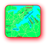
Map of area between
Vittoriosa and Valletta
Initially we had a look around the beautiful harbour/marina (Dockyard Creek) and admired the boats there, including some very expensive looking ocean going yachts. We then left the waterfront and turned right towards Senglia. Immediately we met a less pleasant aspect of Malta - traffic. The Maltese love their cars and here we started to encounter them; the noise and general closeness to them was certainly a contrast to the serenity of the waterfront at Vittoriosa, which we had just left behind.
Reaching the southern side of Senglia, we turned right (north) as if we were going to go to the end of the peninsular on which it is situated, but then we immediately went left and ascended a steep street/road. At the top of this rise we were able to look down on our right to the industrial area around French Creek. This was very much a contrast to Dockyard Creek with cranes and engineering rather than the expensive boats we had seen earlier.
Continuing we soon found ourselves going through a road tunnel and were pleased to exit it - exhaust fumes are not very pleasant - to reach the outskirts of Paola.
Somewhere along our route towards Paola I missed a turn to the right, which existed on the map I was using but was no longer apparent on the ground! So I asked a Maltese Lady directions. The conversation went something like this.
"Excuse me, can you tell me the best way to get to Marsa Creek" ( I knew we should go close to this).
"Marsa Creek!"
"Yes, we are going to Valletta"
"You need the bus"
"No we want to walk there"
"You need the bus"
"But we're walking"
(I'm half expecting her to say "You English you’re crazy" but she holds it back and says), "You need to go back, turn left and, at the next traffic island, follow the bus route"
So we turned around before turning left, leaving behind a Maltese Lady who clearly thought we were a bit "strange" or even worse.
By now Anne was saying that she wasn't enjoying this walk. And I was saying "Don't worry it should soon get better; we can take a turn to the right and get to a less congested road nearer the Grand Harbour".
We reached a small cafe just beyond the massive Marsa Traffic Island, so I went inside to ask if we could get to the Grand Harbour and walk alongside it into Valletta.
"Follow signs and bus route" was the response. So we continued to enjoy the traffic (dual carriageway at this point) as we headed ever onwards towards Valletta.
And then we came to a junction and the main road went left, which I felt was not the right direction, so I asked a group of men outside a business called Billy Engineers.
"We're walking to Valletta. Can you tell me the way to go please?" To which one of the group replied - "You must be nuts". But he did give me directions, which were to the right of the bus route, up the hill past a church on the left, and by a Recreation Ground and then straight on.
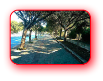
Reaching the Recreation Ground - gardens with a children's play area - we stopped to have a drink and a short rest away from the traffic. From here it was much easier. Although we had the traffic with us on our left, on our right we started to get views of the Grand Harbour and soon we were able to walk through gardens and along pavements more protected from the busy road. It was certainly a much more comfortable and interesting walk from this point on. We even took a minor detour to visit the Lascaris Gardens, which, besides the flora which Anne really enjoyed, had wonderful views across the Grand Harbour. Then we entered Valletta through the Bus Terminal. This certainly seemed an appropriate way into the city.
Views from the Lascaris Gardens.
From here, after a brief wander around Republic Street, the city's main thoroughfare, we went to the Upper Barracca Gardens. Here are some of the best views of the Grand Harbour; it's one of our favourite parts of Valletta.
Views from the Upper Barracca Gardens.

Map of area between Vittoriosa and
Valletta showing our route
Would I do this walk again? Probably not and certainly if I asked Anne to do it again I know what the answer would be. Although looking at a different map to the one I used on the walk - this one has more detail of the approach into Valletta - it would seem that we should have been able to get to a road that skirted the Grand Harbour and taken us away from the noise and traffic of our route. Still it was an "unforgettable" experience.
Don't forget if you want to see our route from Valletta to Sliema it is available at brilwalks.com.
Since writing the above I received an email from Vince Debono, a tour guide in Malta, part of which is included below....
......Re the walk between Vittoriosa and Valletta, there is a possibility of approaching Valletta away from the bus route. At the point where you were labelled as Nuts, at the Billy Engineers, you should (next time?) take the route past the power station down to the harbour. Past the Sea Malta offices, on to the Viset Cruise Liner Terminal , customs house and through Lascaris Bastion then
1) either follow the water and up to Fort St. Elmo near the Siege Bell or
2) go left in through Victoria Gate past the British Hotel....
More emails followed. These culminated in Vince sending photographs and route details. So if you are interested in the route from the Marsa Traffic Intersection to Valletta then Click Here .