

Walk 3 - Sliema to Bahar ic-Caghaq (Ronnie’s Bar)
Sunday, 21st March 2004.
Approximate Distance 5.5 miles
Getting to Sliema From St Paul’s Bay – No. 652 Bus
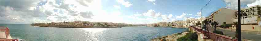
Sliema is nearly always very busy, and the cafes and bars, especially those with views across the Strand and Sliema Creek to Valletta, are particularly busy when the sun is shining. The day we did part three of our walk across Malta was a sunny Sunday and Sliema was crowded, so we quickly left the Strand and views of Valletta to go up Trig il Tori and within 10 minutes we were walking along the promenade on the north side of the town.
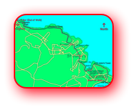

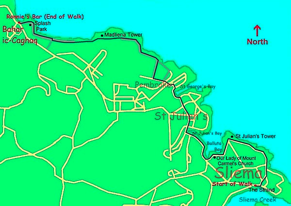
Map of the route taken from Sliema
to Bahar ic-Caghaq (Ronnie’s Bar).
The wide promenade, which initially goes north before turning left (west), is a very pleasant walk especially on a Sunday, when many families are enjoying the sun and the views, and individuals are taking advantage of the flatness of the promenade for "exercising" on cycles, scooters and roller skates. I don’t normally approve of cyclists on pavements but the promenade is wide and the cyclists I saw were having a leisurely ride rather than going fast and being a nuisance or danger to other promenade users.
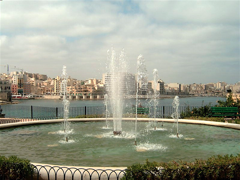
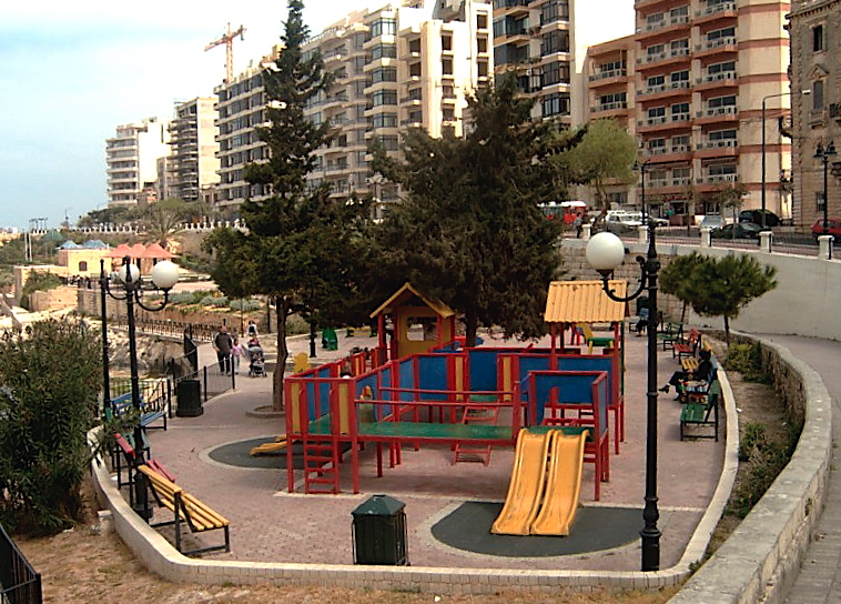
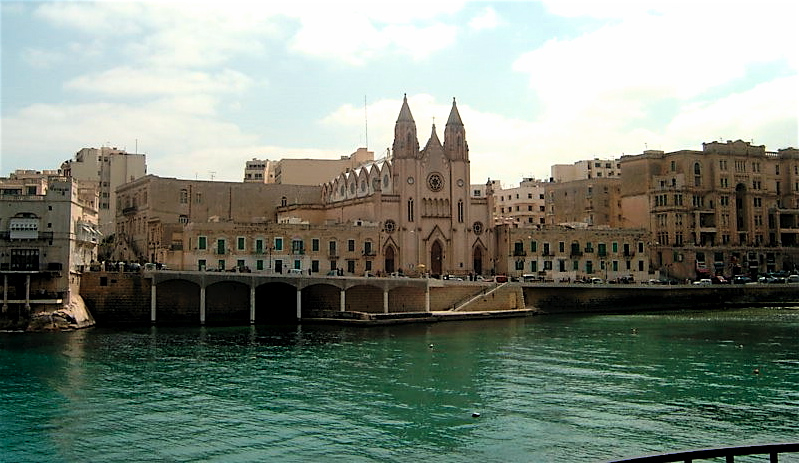
As we continued westwards, still on Trig il Tori near St. Juliens Tower, the rocky seaward side of the Promenade is replaced by some beautiful gardens with flowers and fountains, and many children’s play areas, which were being well used on such a lovely morning. Then we came to Balluta Bay, and were just in time to see the congregation exiting Our Lady of Mount Carmel’s Church, one of the 365 churches on Malta.
-
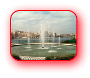
Fountain in Sliema.
-
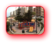
One of the many children's playgrounds near the
Sliema Promenade. -
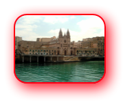
Our Lady of Mount Carmel’s Church that overlooks
Balluta Bay.
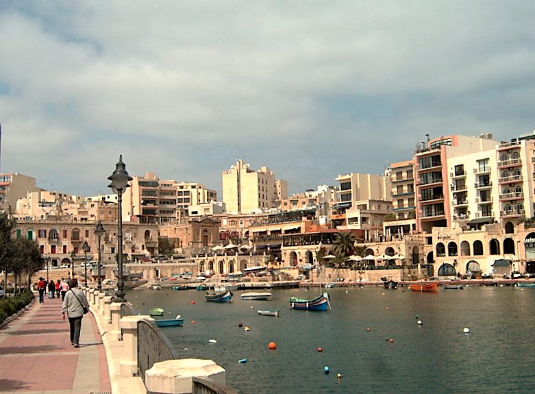
Our route continued along the coast and in a short time we reached St. Julians. St Julians Bay has got to be one of the most beautiful "built up" bays in Malta with the promenade to its south and a number of restaurants on its north side, but, whatever direction the bay is viewed from, it is very pretty especially with many brightly painted boats floating on the crystal clear sea.
By now we had walked a very pleasant 2 miles and it was with a little regret that we said goodbye to the coast and started walking through Paceville, noted for its abundance of nighttime entertainment and particularly attractive to youngsters. This place is certainly not for oldies like Anne and me to visit in the evening, but during daylight hours it is not unacceptable.
We walked north, straight over the traffic lights and then, where the main road (the Coast Road) turns left uphill towards St Paul’s’ Bay, we went straight on along Triq San Gorg (St Georges Road). It is then straight over the crossroads, which are about 150 yards further on, and, where this narrow road forks either branch can be taken as both of these routes go downhill to reach St George’s Bay. We took the left fork and went down steps to a large shopping complex. In front of this complex, which includes a very small Marks and Spencer Food Shop, we turned right to get to the bay.
When St Georges Bay was reached we turned left and walked with the sea on our right. We then went right, as if to go to the bay’s mouth. In front of us were a couple of cafes. These we walked past and then turned left to ascend up a very steep street (it’s a one way street and the traffic goes downhill).
-
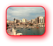
Approaching St Juliens Bay.
-
Another view of St. Juliens.
-
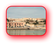
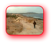
St George's Bay showing the road we took to Pembroke.
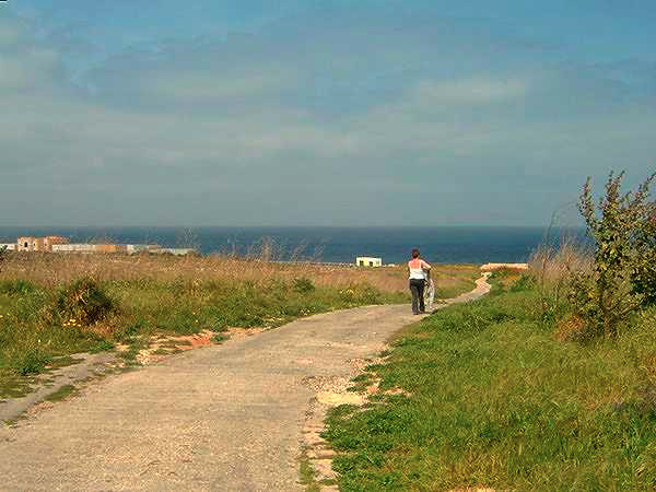
At the top we crossed the road and, having gone slightly left and then right, we approached a traffic island. Our route was to take the exit straight ahead which went up a slight rise. There is a bus stop on the top of this rise, new housing on the left and a large undeveloped area to the right. We followed the road downhill for about 100 yards and took a tarmac track on the right that went downhill to the coast through scrubland with plenty of vegetation for Anne to stop and admire.
-
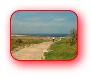
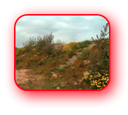
Walking towards the coast
at PembrokeTime to examine the vegitation.
-
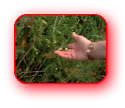
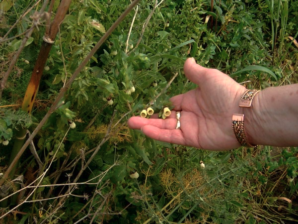
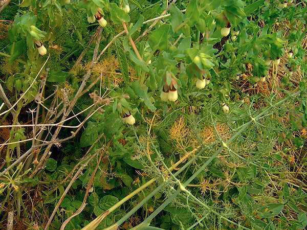
Time to examine the vegetation.
-
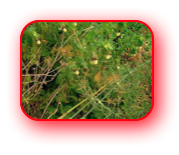
Anne has yet to identify
this plant.
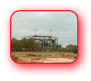
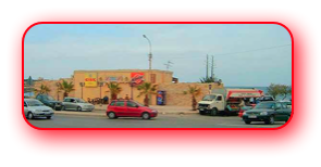
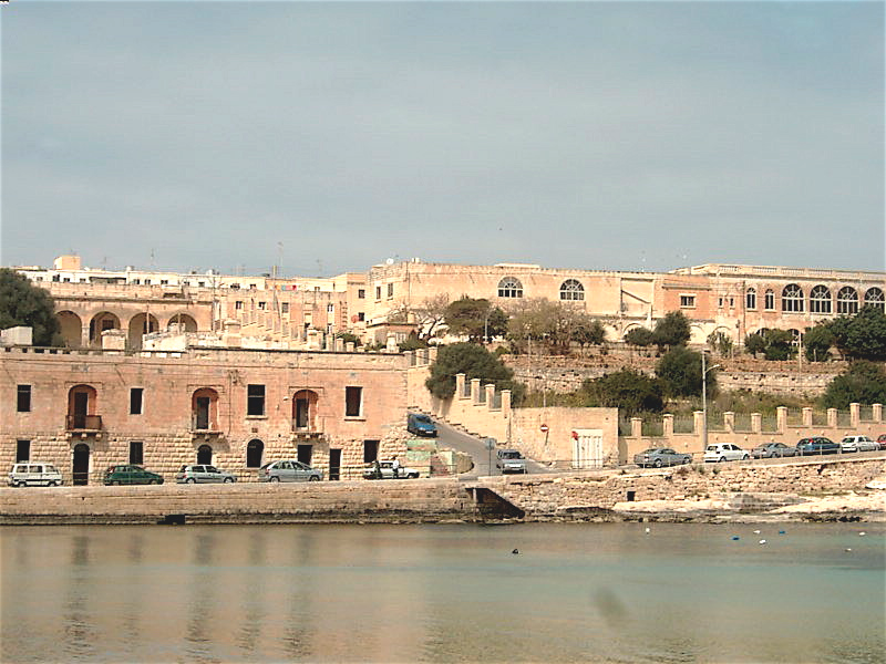
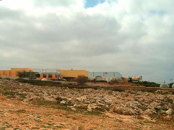
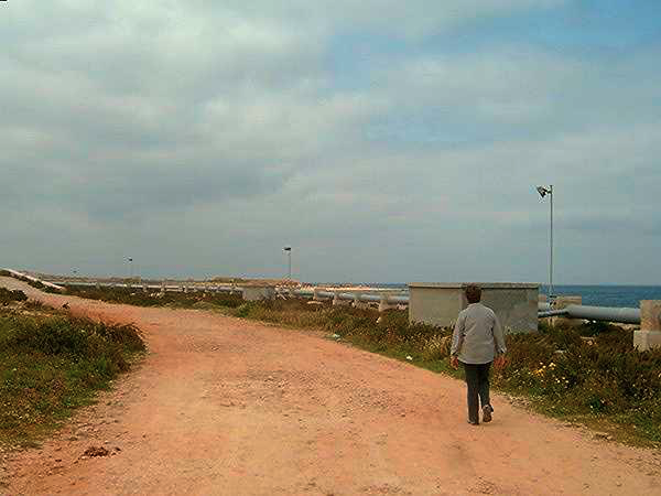
This area of Malta is known as Pembroke and was once the site of an army base. Much of the area is gradually being developed. As mentioned we had already passed a new housing development and now in front of us we could see an industrial complex adjacent to the coastline. We turned left when we reached a T junction of paths a few yards from the sea and passed between the industrial unit on our left and massive pipes on our right that blocked our view of the sea for a short distance. I’m not sure what the “industry” was but I suspect because of its location and the pipes, that it was a desalination plant. If you can confirm this please let me know.
-
Near the industrial plant in Pembroke which is located next to the sea. Is it a desalination plant?
-
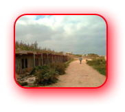
Anne walking besides the
large pipes that were between us and the sea.
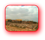
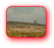
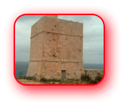
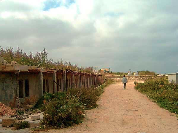
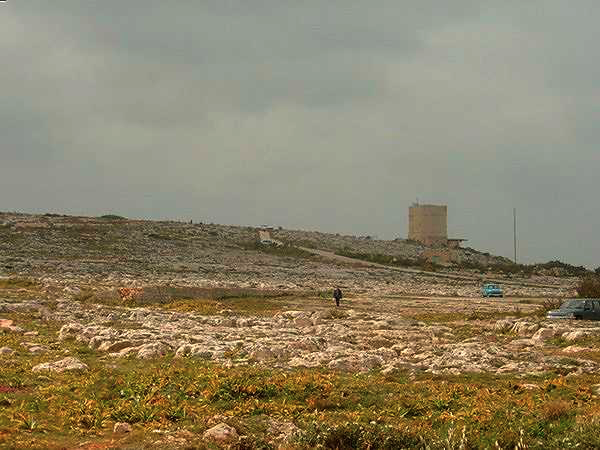
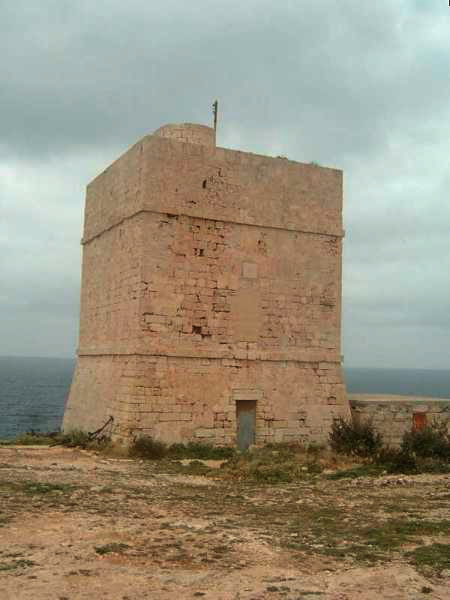
We continued along the path and in a short time the Madliena Tower, one of the look out towers that are dotted along the coast of Malta, is seen about a mile away. As our route goes past this tower, it is a useful aid to navigation. However, rather than go straight to it we did a small detour taking in the old rifle range embankments that would have been used by the British Army when they had their base at Pembroke. In fact I understand that the whole of this area was army land and besides the rifle range many army buildings are also evident in this area.
-
Would the buildings on the left have been barracks for the service men stationed here?
-
The embankment that would have offered protection from stray bullets when the rifle range was in use.
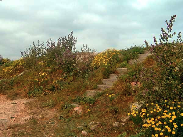
Having wandered around this area, which, being a Sunday, was being well used by the locals for family gatherings and picnics, we headed up the tarmac track, which gives vehicles access to the base of Madliena Tower.
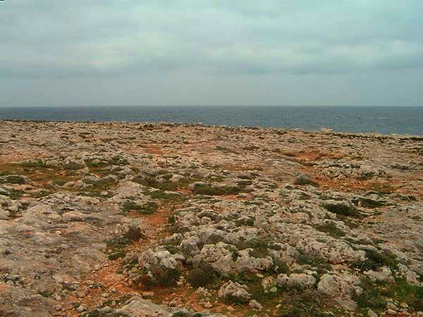
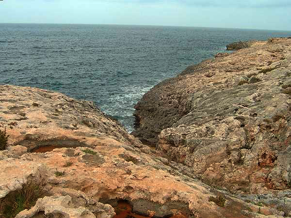
Perched on the top of a small hill above the shoreline we had good views from the tower and were able to see the way ahead, which was initially over coralline limestone, which is very difficult to walk on, and so it was a relief to see a little further on the beginnings of a track. We aimed straight for the track. However, as walked over the limestone we realised it may have been wiser to go downhill towards the sea shore and then follow the strata rather than undertaking a diagonal descent. Picking our way over the landscape only lasted about 10 minutes before the vague track was reached and progress became considerably easier.
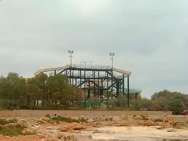
Five to ten minutes later we reached a T junction with a metalled track. Left went inland but we went right towards the sea. Minutes later, as the sea was reached, we turned left and followed a path, which as we progressed got better and much wider. Spotting a waterslide in the distance, part of the Slash Park at Bahar ic-Caghar, we knew that the end of this part of our island walk would soon be over.
-

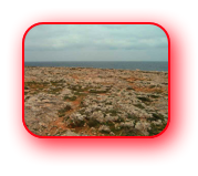
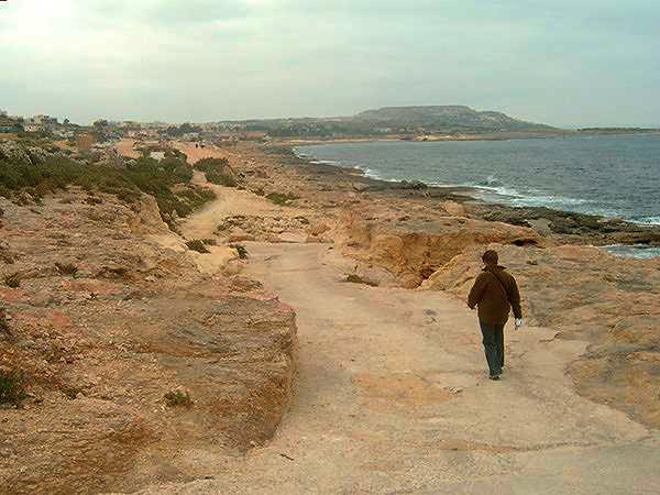
This part of the coastline is very ragged - more Coralline Limestone
-
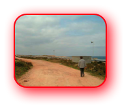
On a solid track heading to Ronnie's Bar. The plateau in the distance is the local rubbish dump*
-
One of the attractions at the Splash park at Bahar ic-Caghaq.
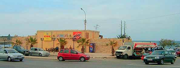
Like so many parts of these walks when civilization is reached the coastal paths become rough car parking areas and then a road materialises. This was no different. On the road we walked behind the aforementioned Splash Park, and more people were noted. We continued and as the road went left, to roughly follow the coastline, we could see the rear of Ronnie’s Bar and a parking area teaming with people, vehicles, fruit and vegetable sellers and ice cream vans. It seems that on sunny Sundays this area is a magnet for the Maltese. However we were attracted to Ronnie’s Bar and a cool drink. Although I had passed Ronnie’s Bar many times, when journeying between St Paul’s Bay and Sliema, this was the first time we had been in the building. It was much smaller than I expected and was very much a bar for the locals, but we were made welcome and sat in a corner and enjoyed our drinks before getting a No. 70 bus to Bugibba and then walking the short distance to our hotel in St Paul’s bay.
Return to top of page